
-
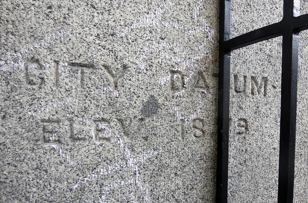
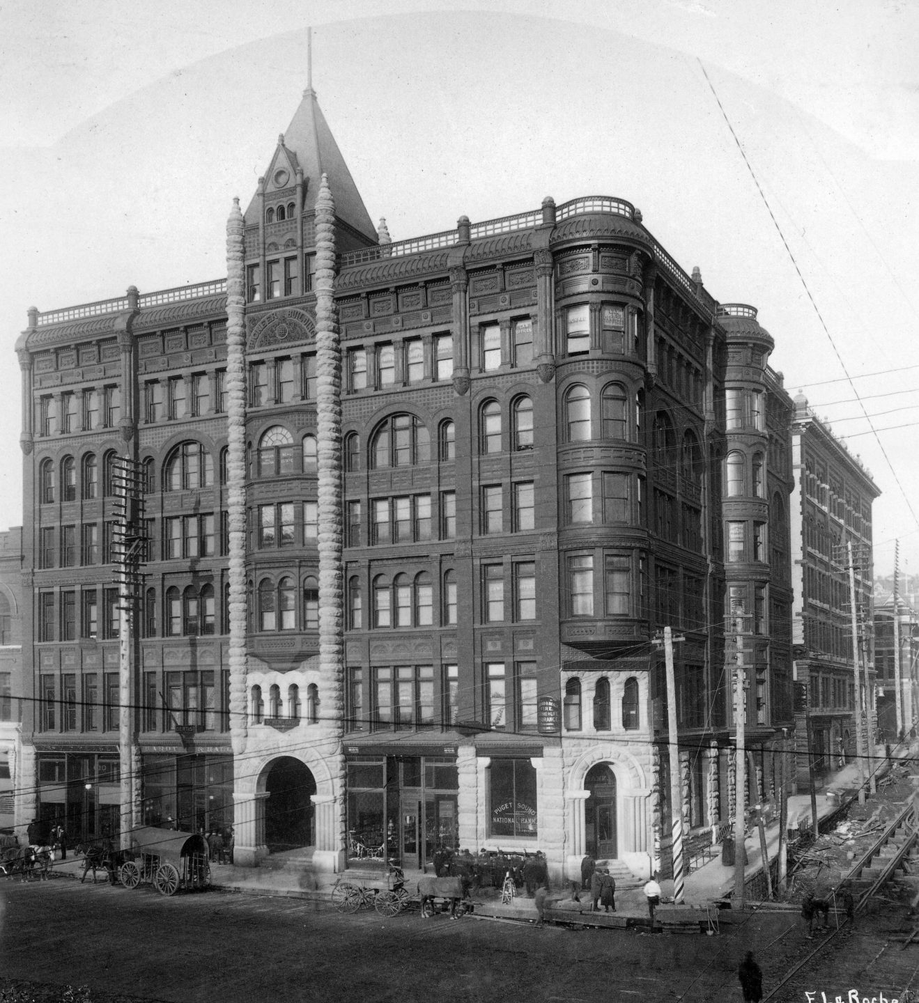
City datum point inscribed on Pioneer Building
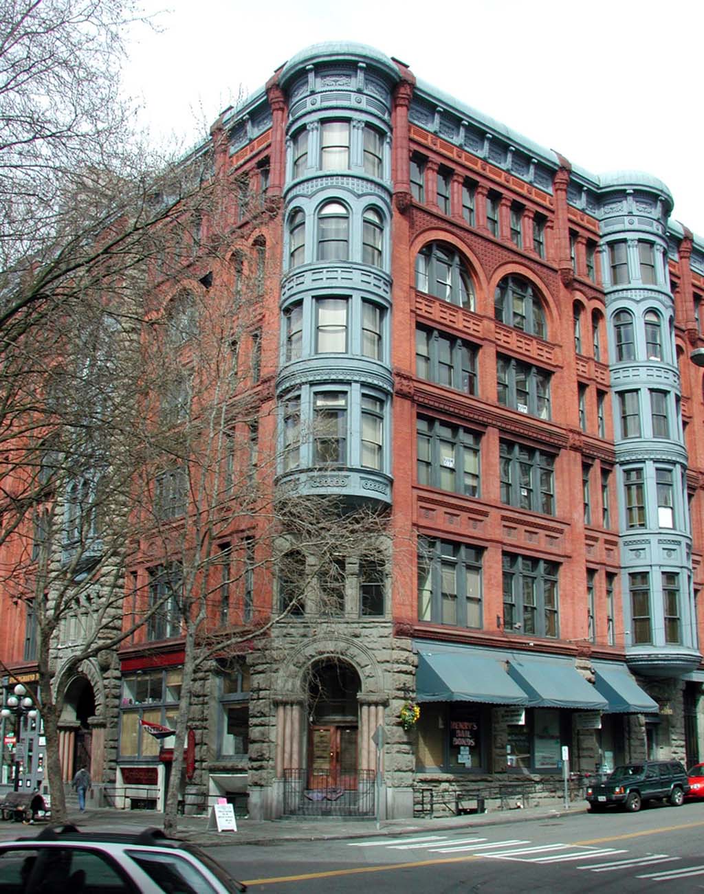
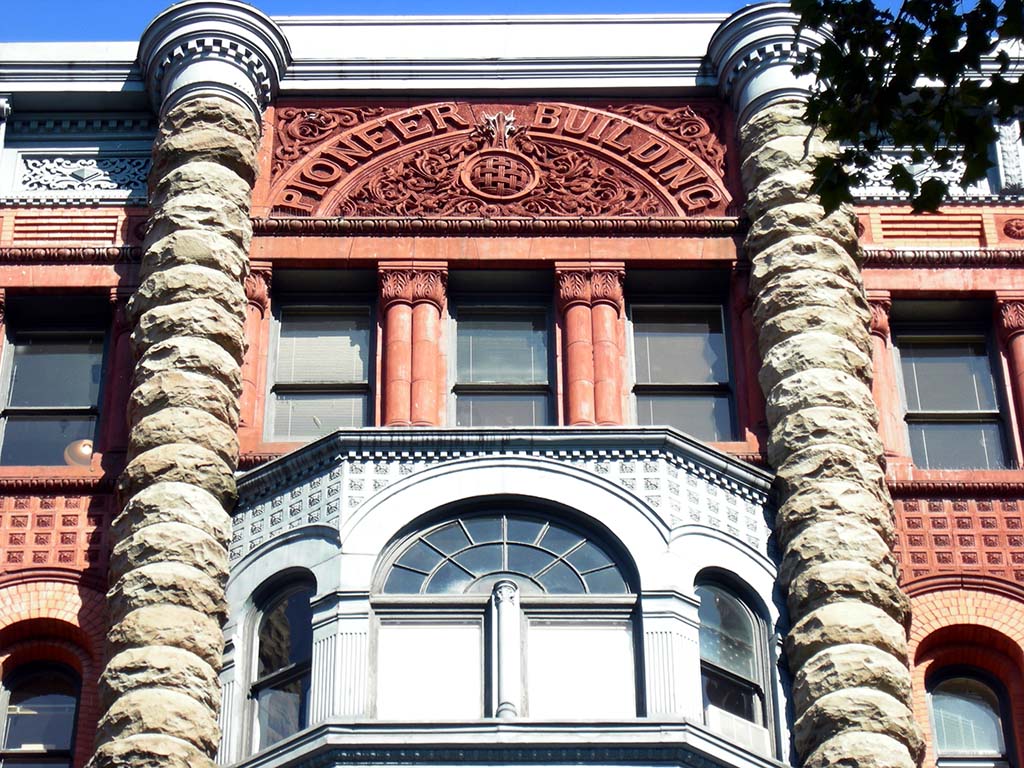
600 1st Avenue
600 1st Avenue
You are standing at one of the baseline points of Seattle. Look at the corner of the Pioneer Building, where you can see the following words and numbers carved into the granite. “City Datum: Elev. -18.79” This refers to what can be described as the zero point, or sea level, in Seattle, the elevation which all elevations in the city are based. Having such an established baseline is key because it allowed engineers to work with the same information: that the square carved in the step at your feet is 18.79 feet above the zero point.
A second key feature at this location is the curious street alignment north and south of Yesler Way. In 1853, Doc Maynard, Carson Boren, and Arthur Denny decided to plat their land claims (basically illegally taking land from the Native inhabitants because treaties ceding the land had not been signed), which led to Denny (a former surveyor) and Maynard establishing a street grid. Following the accepted procedures for platting, Maynard aligned his street with the compass, North/South and East/West. Denny, in contrast, aligned his with the waterfront, which was along modern First Avenue, originally Front Street. This led to a Northwest/Southeast grid, and the subsequent mismatch at Yesler Avenue.
When originally platted, Yesler Avenue was named Mill Street, in honor of Henry Yesler’s mill, which extended over the water west of here. That mill led to another, informal name for the street, Skid Road, in reference to the logs skidded, or slid, down from the surrounding hills. Although Seattle often lays claim to the origin of the term in reference to a derelict area, skid road was a term long applied to logging areas. No matter the origin, Skid Road was long a dividing line between the poorer neighborhoods to the south and the wealthier “establishment” areas to the north. Other names for the area to the south have been tenderloin, lava beds, and White Chapel.
Walk back to First Avenue, turn left, walk one block south to S Washington Street, turn right, walk a half block west to just past the alley. On the south side of the street is a red brick building with a sign for St. Charles Hotel above the second story.