-
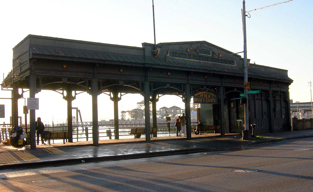
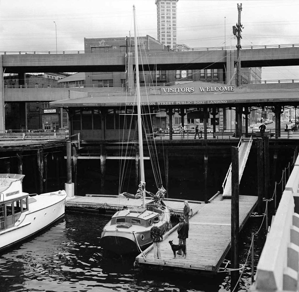
Washington Street Boat Landing
199 Alaskan Way
Landing at foot of Washington Street
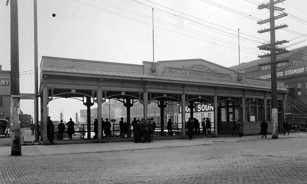
The Washington Street Boat Landing was built as the Naval Shore Station and opened for use on July 3, 1920. Built for use by small craft that carried sailors to shore from larger ships anchored in Elliott Bay and from the Sand Point Naval Station on Lake Washington, the station also acted as moorage and an office for the city’s harbor patrol. On the south side of the station’s long slip, enlisted men’s barges used one float, and on the north side, officer’s barges tied up to another float. More than 80 feet of additional space was provided for other vessels, including the harbor patrol. Gracing the station was an 86-foot-wide wrought-iron pergola designed by City Architect Daniel R. Huntington (1871-1962).
Besides housing the harbor patrol, the structure added a decorative element to the waterfront, and became a maritime gateway to the city. In the early 1970s, the aging pergola was saved by the women who made up the Committee of 33, a “group of congenial people who love their city and wish to enhance it in a meaningful way.” The committee sought out projects for which it could provide seed money. Its donation for improvements to the wrought-iron pergola spurred others to help the cause, and the structure was restored in the mid-1970s. The renamed Washington Street Public Boat Landing Facility was added to the Pioneer Square Historic District in 1973 and the National Register of Historic Places in 1974. The structure was recently refurbished and replaced on the shoreline overlooking the beach.
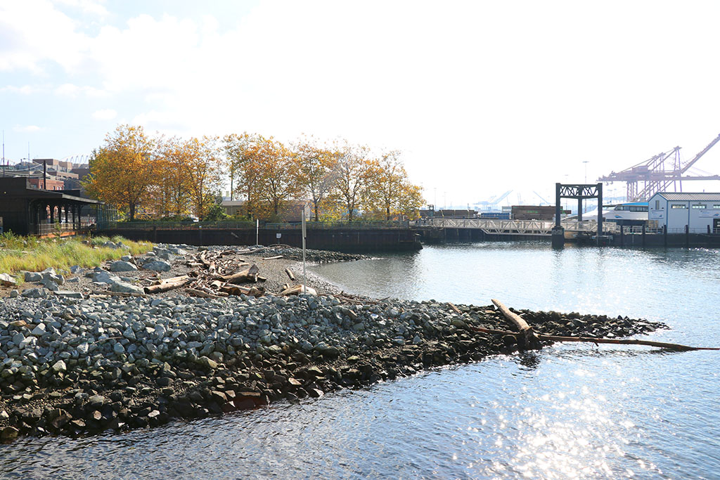
The new habitat beach on the west side of the landing was completed in December 2019. It was built as a transition zone between deep water in the bay and the habitat shelf, a ledge of concrete extending out from the seawall’s face, constructed as part of the new seawall extending north to Broad Street. A study by the University of Washington’s School of Aquatic and Fishery Science informed the design of the habitat shelf. It found that a horizontal surface molded into cobbled shape encouraged mussel and algae growth. Other flora and fauna will grow on the shelves, but the study focused on mussels and algae because they are key elements in attracting small invertebrates, which, in turn, provide food for juvenile salmon and other fish.
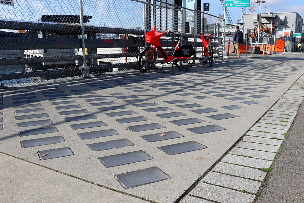
Glass blocks in the sidewalk along Alaskan Way provide light to the water along the shelf, which attracts fish that might otherwise follow the outer edges of the piers to avoid the dark under-pier areas. Keeping closer to the wall and in shallower water helps protect the fish from predators. The “fish highway” along the wall serves as a partial proxy for the former estuary and increases survival rates of salmon migrating through Elliott Bay to and from the Duwamish River.
Artist Buster Simpson’s installation of Migration Stage includes two elements: Anthropomorphic Triapods on the beach and SeaBarrier on the upland. Their designs reference Native and working histories on the waterfront.